Satellite Imaging
WinChips v.4 7
Chips, the Copenhagen Image Processing System, is a general-purpose software package for remote sensing image processing and spatial data analysis with extensive support for NOAA AVHRR data.
ERDAS ECW JPEG 2000 Plug-in for v.11.0.1.250
Digital imagery is becoming more and more ubiquitous as time goes by.
Trellian WorldTime v.2.2.2.4415
World Time is a simple to use but intelligent graphical utility that displays in real time, not only the time in cities around the world, but it also features viewable time zones, which displays night and day around the world.
SmartDeploy Imaging Component v.2.1.0.0
The SmartDeploy Imaging Component (SmartWIM) provides programmatic access to the Windows Imaging File Format (WIM), a file-based volume imaging solution developed by Microsoft to help optimize the deployment of Windows.

Dish Satellite TV v.1.0
Dish Satellite TV. Dish Network Discounts. Dish Network TV Deals! Dish Network Television Deals and Free Offers! DISH Network installation and service nationwide. Satellite TV systems from Profressional Dealers.
Portable Satellite Radio Desktop Alert v.1.0
This is a very easy to use desktop application that will alert you whenever new articles are added to Portable Satellite Radio.com. Simply install the software and any time new content is added to the website,
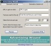
PC Satellite TV v.1.0
PC Satellite TV Advertising Wizard. There are programs for Linux that allows a person to watch television through his or her PC using a TV tuner or a Satellite receiver card DVB-S. Some of these programs does not use a general purpose widget set, so
Satellite TV
Stop paying for high-priced cable or Satellite Watch TV in English, Spanish, German, Arabic, French, Italian, Russian, Dutch and more! You may also browse world TV by regions or by country name. FOR EXAMPLE YOU WILL GET STATIONS FROM THE
Satellite Free VST v.1.0
Satellite Free VST is a free and exclusive VST/AU/RTAS Plug-In Instrument. It's multi-timbral, has great filters, effects and a built-in mixer. Use it in your DAW (Logic, Cubase,Pro Tools, Live, etc) to play the sounds you downloaded.
NEO iMAGING v.1.0.1
nEO iMAGING is an image processing software enable everyone to achieve professional-like result in just few clicks. It supports more than 30 common graphic formats including raw formats from most popular camera models.
Global Satellite Map v.8.0.0.6028
Global satellite map is a very high resolution global satellite image mosaic of the earth,These images have been collected during 2000-2004, and one of the bands has a ground relative resolution of 15 meters, or 50 foot.
Hardscape Imaging Software v.1 3
IMAGING SOFTWARE enables your potential customers to visualize what different patterns and colors of pavers will look like as if they were already installed. - Easy to learn. Includes training movies and tutorials.